Which side of the River?
 These days, every time I see an old map of Warton and Carnforth my eye is drawn ineluctably towards the bridge over the River Keer and the nearby mill. This is the neighbourhood where John Lucas was born in 1684.
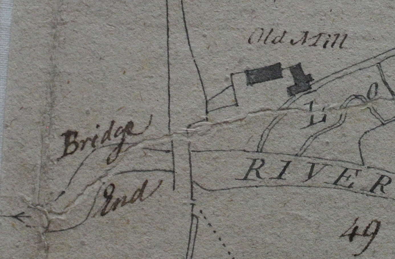
“About a Hundred Yards West from the Mill is a House called Brig End, in which I drew my first breath” he writes in ‘A History of Warton Parish’. But on which side of the river was Brig End: the Warton side or the Carnforth side?
I was excited earlier this month when I was shown an old, recently rediscovered map. Originally drawn up in 1794 for a Warton landowner, Charles Clowes, it surfaced in a batch of books bought at a car boot sale in Lancaster last year by Cheryl McDonagh from Morecambe. And this is what it shows of that patch of land down by the River Keer. Bridge End is shown West of the old Mill — just as Lucas describes — downstream from the bridge over the Keer. The road leads north towards Warton and south towards the centre of Carnforth.
But which side of the river is Bridge (or Brig) End? It’s not clear from this map – the two words straddle the river! And there is no outline of a building. I haven’t yet made a comprehensive search of all old maps of Carnforth and Warton. And if anyone has seen one which shows which side of the river Brig End is situated I’d be delighted to hear from them.
Up until now I’ve relied on another piece of evidence which implies, I think, that John Lucas was born in Carnforth rather than Warton: his self-penned epitaph.
‘Carnforth begat Me, Warton Instructed Me, elevated in Leeds, famous for its Cloth, This Stone covers my Remains.’
It should be said also that John Rawlinson Ford, the local historian who edited the 1931 edition of the History of Warton Parish states clearly that Lucas was “born at Carnforth”.
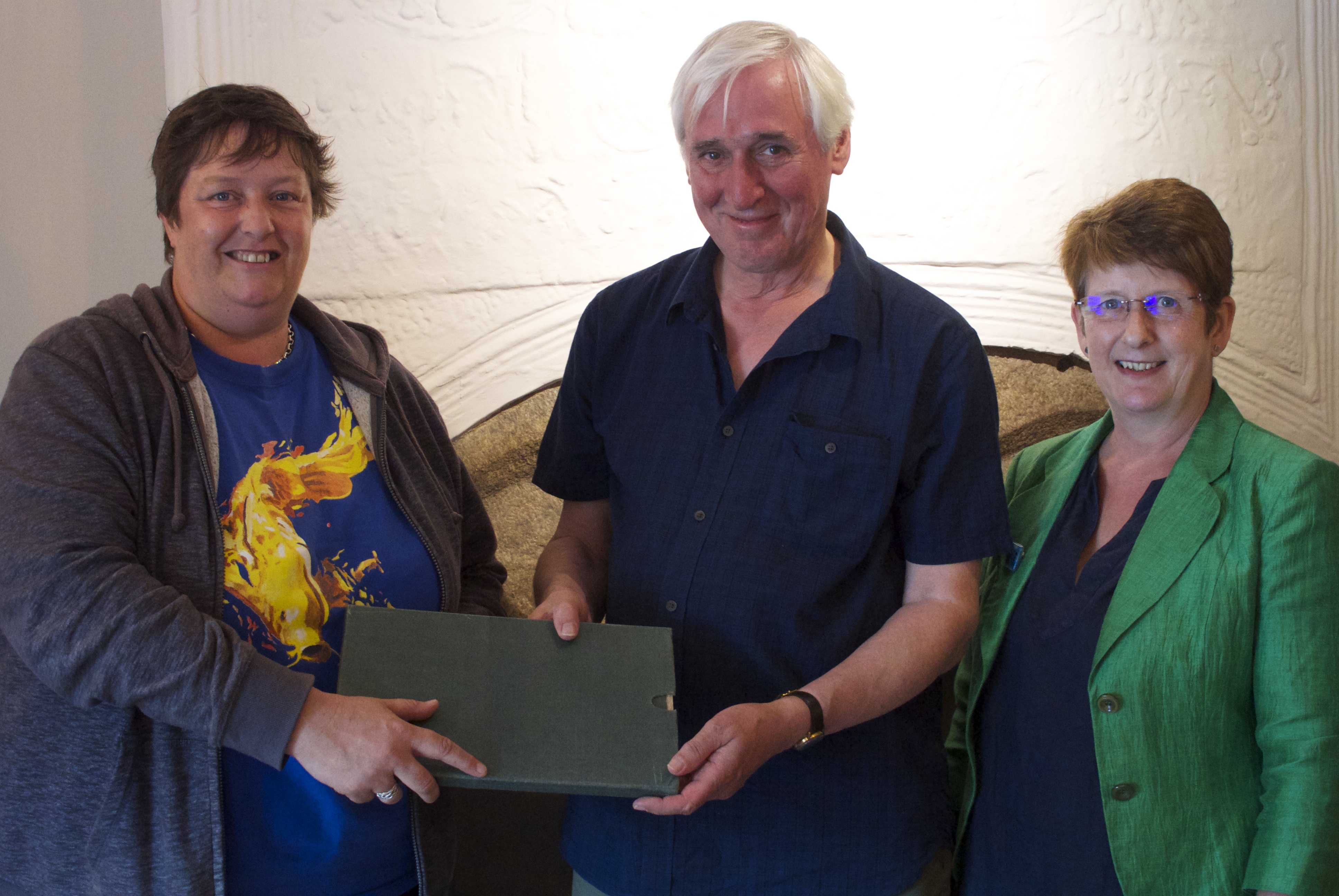
The Clowes map, incidentally, has now been purchased jointly by the Mourholme History Society and the Friends of Lancashire Archives and will shortly be available to view at the County Record office in Preston. There was an official but informal handover of the map at the New Inn, Yealand Conyers in July. Mourholme History Society Chair Simon Williams is seen receiving the map from Cheryle McDonagh, with Jacquie Crosby of County Records alongside.